Key Himalayan Geographical Offerings Of The Panpatia Col Trek
9 Popular Peaks:
Balakun ( 6471m ), Chaukhamba I ( 7138m ), Chaukhamba II ( 7058m ), Chaukhamba III ( 6974m ), Chaukhamba IV ( 6854m ), Gauri Parbat ( 6708m ), Hathi Parbat ( 6727m ), Mandani Parvat ( 6193m ), Nilkantha ( 6596m )
2 High Passes:
Kachni Khal ( 4400m ), PANPATIA COL ( 5200m )
1 Mind-boggling Glaciers:
Panpatia Glacier
1 Beautiful Remote Villages:
Badrinath
Media Gallery For Panpatia Col Trekclick to see all videos, photos, route maps, etc. for this trek
- Day 1
- D1Rishikesh
- Day 2
- D2Joshimath
- Day 2
- Khirao Road Head
- Day 3
- D3Khirao C1
- Day 4
- D4Khiroi C2
- Day 5
- D5Khirao Snout Camp
- Day 6
- D6Moraine Camp
- Day 7
- D7Moraine Camp
- Day 8
- D8Parvati Col Base
- Day 8
- Parvati Col
- Day 9
- D9Panpatia Snowfield
- Day 9
- Panpatia Col
- Day 10
- D10Sujal Sarovar Camp
- Day 11
- D11Kachni Dhar
- Day 12
- D12Nanu Chatti
- Day 13
- D13Ransi
- Day 14
- D14Rishikesh
- Day 15
- Rishikesh
Panpatia Col Trek Daywise Itinerary
Day 1Arrival In Joshimath
Overnight In: Joshimath (1850m )
Accommodation: Hotel
Meals Included: All Meals
Cost Of Transport Included: No
Activity: Drive Day
Journey from Rishikesh to Joshimath is a long one, but definitely not a boring one. As you swirl up, you come accross the Prayags ( confluence of rivers) of Uttrakhand, coming down from the Himalayan Glaciers on the higher reaches of the Himalayan state. These rivers unite to form the mighty Ganga which flows down Haridwar to rest for India. Ganga is known as the lifeline of India, and Uttrakhand - The Dev Bhoomi ( God's Land)
The streets are colorful too !!
Travelling in mountain roads for 280 KMS can be really tiring. So take a good sleep in your hotel tonight.
Day 2From Joshimath To Khirao C1, Via - Khirao Road Head
- Day 2
- 1850 - Joshimath
- Day 2
- 2400 - Khirao Road Head
- Day 2
- 2590 - Khirao C1
3hrs.Activity: Drive, Trek Day
Overnight In: Khirao C1 (2586m )
Accommodation: Tents
Meals Included: All Meals
Today morning we drive to Khirao, and the trek some 30 minutes to reach our base camp for the trek. We may chose to visit the holy Shrine of Badrinath, offer prayers and then come back to our base camp as we have little less to do.
Reach base camp and relax for the day
Day 3From Khiroi C1 To Khiroi C2
- Day 3
- 2590 - Khiroi C1
- Day 3
- 3530 - Khiroi C2
5 - 6hrs.Activity: Trek Day
Overnight In: Khiroi C2 (3526m )
Accommodation: Tents
Meals Included: All Meals
Following the Khiroi Ganga upwards, we climb and climb to reach the campsite for the day
Day 4From Khiroi C2 To Khirao Snout Camp
- Day 4
- 3530 - Khiroi C2
- Day 4
- 3900 - Khirao Snout Camp
5 - 6hrs.Activity: Trek Day
Overnight In: Khirao Snout Camp (3897m )
Accommodation: Tents
Meals Included: All Meals
Reach the snout of the Panpatia glacier.
Day 5From Khirao Snout Camp To Moraine Camp
- Day 5
- 3900 - Khirao Snout Camp
- Day 5
- 4300 - Moraine Camp
5 - 6hrs.Activity: Trek Day
Overnight In: Moraine Camp (4300m )
Accommodation: Tents
Meals Included: All Meals
Negotiate moraines and difficult terrain. Will be a long day.
Day 6Rest / Acclimatization Day
- Day 6
- 4300 - Moraine Camp
- Day 6
- 4300 - Moraine Camp
3 - 4hrs.Activity: Rest and Acclimatize Day
Overnight In: Moraine Camp (4300m )
Accommodation: Tents
Meals Included: All Meals
Rest and acclimatization Day
Day 7From Moraine Camp To Parvati Col Base
- Day 7
- 4300 - Moraine Camp
- Day 7
- 4670 - Parvati Col Base
6 - 7hrs.Activity: Trek Day
Overnight In: Parvati Col Base (4670m )
Accommodation: Tents
Meals Included: All Meals
The penultimate day before crossing the Panpatia Col. We trek to the base of the Parvati Col
Day 8From Parvati Col Base To Panpatia Snowfield, Via - Parvati Col
- Day 8
- 4670 - Parvati Col Base
- Day 8
- 5185 - Parvati Col
- Day 8
- 5210 - Panpatia Snowfield
6 - 7hrs.Activity: Trek Day
Overnight In: Panpatia Snowfield (5210m )
Accommodation: Tents
Meals Included: All Meals
Will be a hard day. We negotiate steep and difficult climbs through a gully to summit the Parvati Col. We camp in the vast Panpatia snowfield
Day 9From Panpatia Snowfield To Sujal Sarovar Camp, Via - Panpatia Col
- Day 9
- 5210 - Panpatia Snowfield
- Day 9
- 5225 - Panpatia Col
- Day 9
- 4890 - Sujal Sarovar Camp
5 - 6hrs.Activity: Trek Day
Overnight In: Sujal Sarovar Camp (4890m )
Accommodation: Tents
Meals Included: All Meals
We negotiate the rest of snowfields, cross the Panpatia Col to descend down sharply to Sujal Sarovar.
Day 10From Sujal Sarovar Camp To Kachni Dhar
- Day 10
- 4890 - Sujal Sarovar Camp
- Day 10
- 4130 - Kachni Dhar
6 - 7hrs.Activity: Trek Day
Overnight In: Kachni Dhar (4130m )
Accommodation: Tents
Meals Included: All Meals
Cross a pass to descend sharply to Kachni.
Day 11From Kachni Dhar To Nanu Chatti
- Day 11
- 4130 - Kachni Dhar
- Day 11
- 1800 - Nanu Chatti
6 - 7hrs.Activity: Trek Day
Overnight In: Nanu Chatti (1800m )
Accommodation: hotel/ tents
Meals Included: All Meals
We trek to Madhyamaheshwar temple, offer our prayers and then trek to Nanu Chatti
Day 12From Nanu Chatti To Ransi
- Day 12
- 1800 - Nanu Chatti
- Day 12
- 1620 - Ransi
4 - 5hrs.Activity: Trek Day
Overnight In: Ransi (1619m )
Accommodation: Hotel / Ransi
Meals Included: All Meals
Today We finish the trek at Ransi
Day 13From Ransi To Rishikesh
- Day 13
- 1620 - Ransi
- Day 13
- 375 - Rishikesh
6 - 7hrs.Activity: Drive Day
Overnight In: Rishikesh (372m )
Accommodation: None
Meals Included: Breakfast
We drive back to Rishikesh
Day 14Reserved Day For Contingency
This is a planned reserved day to keep window for bad weather and other contiongencies. If unutilized, we can spend this day in any other campsite of our liking. The cost of this day is included in the trek package. If you decide to finish your trek instead of utilizing this resereved day, no money will be refunded and the local resources will be paid in full.
Why Should You Do The Panpatia Col Trek
- A historic route !! An interesting mythological story has it that a sage used to perform his daily rituals of worship in Badrinath and Kedarnath on the same day.
- Lots of World class explorers like Tillman, Eric Shipton, Meade have put their efforts to find a route connecting the 2 shrines.
- Lots of Indian mountaineers put their effort in connecting the same, and in 2007 a gift was given to the trekking community in form of a trekkable route.
- The dangerous, crevasse laiden massive and wide spread ice field of Panpatiya
Panpatia Col Trek - Elaborate Description
Connecting two of the holy shrines of Hindu - Badrinath and Kedarnath, a mythological story has it that a sage used to perform rituals in both the temples on the same day using this route known as Kedar Badri. This created enough crest amongst the mountaineers and explorers to find a route connecting the two shrines of Kedarnath and Badrinath.
British explorers to the likes of Tillman and Eric Shipton set their foot to find a route through them in 1934. They entered through the Satopanth glacier from Badrinath side, crossed the col, but got trapped in dense bamboo forest of Gondharpongi valley, before returning to Joshimath for his Nanda Devi expedition. Before them, Meade had his share of efforts in 1912. From then on, lots of steps has been take by mountaineers of our country to find a route connecting them, mostly mountaineers from Bengal including Harish Kapadia in 1997, who was stopped by the Ice fall. In 2000, an English mountaineer Martin Moran lead an expedition to Neelkanth, a nearby peak in Badrinath area to find a route and then successfully negotiated the Panpatia ice falls to exit through Kedarnath making it the first successful attempt completing Shipton's route.
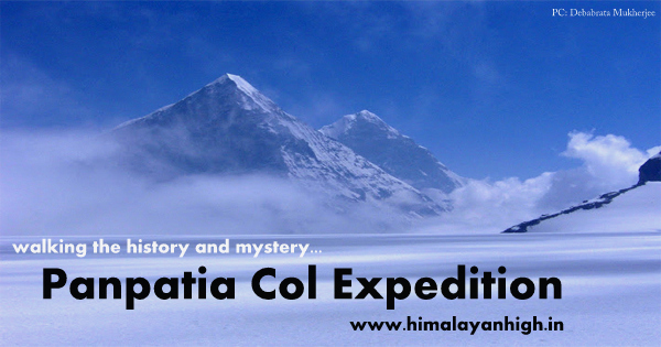
Neelkanth and Parvati seen on Panpatia Trek
photo by Debabrata Mukherjee
Some dedicated and continuous efforts was made by mountaineer Anindya Mukherjee with other fellow mountaineer friends on the same crest. He tried 3 years in row from Madhameshwar side with little more success at each attempt and in his 4th attempt, he tried from the other side.
In 2007, A Bengali team in lead by Tapan Pandit and Debabrata Mukherjee successfully crossed the crevasse laiden ice fields of the Panpatia creating a history, making it a first Indian success on the route. The advantages of Google Earth helped the team to plan a safer route through the ice falls.
The beauty of the 2007 expedition was that, though difficult, this route was trekkable, and In recent times, trekkers crossing it successfully has been reported quite a few times, following the same route. It was a gift to the trekking community by the efforts of the 2007 team.
As understandable, this is not a mere trek. It needs to be treated as a semi-expedition which requires climbing gears like mountaineering boots, ice axes, anchoring devices, ropes and thye most important - right mentality
There is a Himalayan High in trekking this historic route !!